
Food & Ethnobotany 🎯 Grades 5-12 ⏱️ 45 minutes 👥 1-15 students

Community Food Mapping: Spatial Food Security

Food Systems & Participatory GIS • Tyonek Tribal Conservation District Curriculum

Interactive Digital Curriculum

Interactive Walkthrough Slides

Step through the complete digitized curriculum deck with illustrated concepts, step-by-step procedures, teacher tips, and interactive knowledge checks.

🖥️ Interactive Walkthrough Slides
Slide 1 of 6
Download PDF
Slide 1 Spatial Inquiry

Mapping Where Food Lives

Visualizing Tyonek’s Food Landscape

Maps are powerful tools. They don't just show roads and borders—they tell the story of how people survive and flourish on the land.

In this workshop, students become community cartographers, creating a detailed food map of Tyonek that layers ancestral subsistence knowledge with modern greenhouse agriculture.

  • 🐟
    Subsistence Assets: Setnet fishing sites, smokehouses, berry bogs, duck marshes, moose corridors.
  • 🥕
    Cultivated Assets: High tunnels, school gardens, chicken coops, community root cellars.
  • 🏛️
    Infrastructure Assets: Community freezer, elders lunch center, barge landing, local store.
← / → Navigate slides F Fullscreen Esc Exit fullscreen
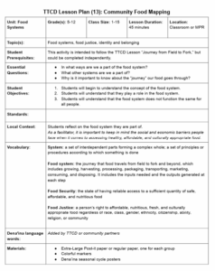
Official curriculum guide preview for Community Food Mapping: Spatial Food Security
📄 13.-Food-Systems_-Community-Food-Mapping.pdf

Essential Inquiries & Learning Targets

Core Essential Questions:

  • What is a community food map, and how does spatial mapping reveal local food assets and vulnerabilities?
  • Where do subsistence harvesting areas (salmon camps, berry patches, hunting trails) intersect with community agricultural sites in Tyonek?
  • How can participatory mapping empower tribal youth to advocate for enhanced food storage and community infrastructure?

Student Learning Objectives:

  • Construct a multi-layer participatory base map of the Tyonek community identifying wild harvest and cultivated food assets.
  • Design a standardized map legend with icons for fish camps, smokehouses, root cellars, berry bogs, and greenhouse beds.
  • Identify seasonal food distribution gaps and propose spatial infrastructure solutions.
Self-Grading Assessment

Comprehension Mastery Quiz

Test student understanding of scientific principles, local Alaska ecology, and problem-solving scenarios from the lesson guide. Earn the Community Food Mapping: Spatial Food Security Master credential!

📝 Comprehension Mastery Quiz Question 1 of 1

What is the primary purpose of a participatory community food map?

Terminology & Dena’ina Context

Specialized Vocabulary Flashcards

🗂️ Interactive Vocabulary Deck Card 1 of 3

Click the card or press Space to flip. Use arrow keys to navigate.

Term Click to flip ↷

Participatory GIS

Definition & Context Click to flip ↶

A community-driven mapping process that incorporates local knowledge, cultural values, and spatial data into decision-making.

Alaska Context:

Geography

Educator Guide

Curriculum Standards & Activity Protocol

📚 Standards Alignment (NGSS & Alaska Cultural Standards)

MS-ESS3-3

Apply scientific principles to design a method for monitoring and minimizing human impacts on the environment.

NGSS

🏔️ Local Alaskan & Tebughna Context

  • Tyonek's geography stretches from the high bluffs overlooking Cook Inlet into the rich riparian corridors of Indian Creek, Robert's Creek, and the Chuitna River.
  • Participatory mapping honors traditional geographic names and seasonal harvest calendars passed down through generations.

📦 Required Materials & Classroom Setup

✓ Large printed aerial satellite poster of Tyonek (approx 24x36 inches)✓ Clear mylar acetate overlay sheets✓ Colored permanent markers✓ Rulers✓ Legend sticker symbols

🔬 Step-by-Step Hands-on Activity Guide

  1. Step 1: Base Map Setup

    Tape aerial base map to tables and secure clear overlay sheets.

  2. Step 2: Legend Agreement

    Agree on color codes and icon symbols for food categories.

  3. Step 3: Asset Plotting

    Plot known harvest zones, gardens, and food storage facilities.

  4. Step 4: Analysis & Proposal

    Identify gaps and write 2 infrastructure recommendations.

💬 Wrap-Up Discussion & Evidence of Learning

Discussion Questions:

  • What was the most surprising food asset you discovered on the map?
  • Why is winter storage the biggest challenge for Alaska village food systems?

Evidence of Learning Rubric:

  • Student creates a spatial map featuring accurate geographic landmarks and food asset icons.
  • Student proposes evidence-based infrastructure solutions to address winter food gaps.
← All Youth Lessons & Resources